
HiperBarrio Maps San Javier La Loma with Open Street Maps

Led by two passionate open source enthusiasts, Fredy Rivera and Elkin Botero, the members of the HiperBarrio collective of youth citizen journalists in Medellín, Colombia have created the first freely accessible online map of their own community.
As little as a year ago Google Maps had no geographic information about San Javier La Loma, a small working class neighborhood on the outskirts of Medellín where the ConVerGentes group of HiperBarrio is based. Some progress has been made, but as you can see from the satellite imagery, most of the streets are still not mapped, much less the parks, buildings and footpaths.

Now, compare that to the map of San Javier La Loma created by HiperBarrio and freely available for nearly unrestricted use on Open Street Maps:

There is clearly an aspect of amateurism to the cartography, but anyone who has been to La Loma will tell you that the second map is a much more useful representation of the community. All of the roads are represented, as are the church, school, and the labyrinthine network of steep footpaths which carry constant pedestrian traffic.
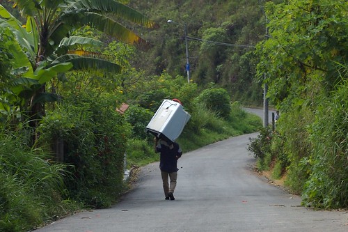
A resident of La Loma carrying a washing machine down the road.
In fact, much of the world is still a blank void on Google Maps, especially slums and lower income communities. Rio de Janeiro is remarkably well-mapped, and even includes public transit information. But if you live in a favela like Santa Marta (where Michael Jackson shot the video to “They Don't Care About Us“) there is no street information at all:

Access to geographic information is crucial to the development of any community. As Mikel Maron, an evangelist of Open Street Maps, puts it: “Without basic knowledge of the geography and resources of [a community] it is impossible to have an informed discussion on how to improve the lives of residents.”
Last Saturday Fredy Rivera, a leading mapper of Open Street Maps based in Bogotá, organized a workshop at the small public library in La Loma to teach its young residents how to make a map of their own community.

Gabriel Vanegas, the librarian in La Loma whose dedication is responsible for much of HiperBarrio's success, explained the background that led to the workshop:
En marzo de este año y gracias a la comunidad de software libre, tuve la oportunidad de conocer a Fredy Rivera un Chef gomoso de la cartografía y Linux, quien estará con nosotros, orientándonos en esto de la construcción colectiva de mapas. Será una excelente oportunidad para seguir reconociendo el territorio desde de la Biblioteca Pública y desde los ejercicios de periodismo ciudadano, la cultura libre, la historia acción-participación y la ciudadanía.
The workshop was later covered and summarized on the website of Medellin's Network of Libraries, a recipient of the Gates Foundation's 2009 Access to Learning award. Fredy Rivera posted a very useful summary of the contents of the workshops (in Spanish) on his blog.

Mark Graham has mapped the total number of of geotagged Wikipedia articles per language, location, and population. He found a “highly uneven geography of information.” An article in The Guardian notes:
Almost the entire continent of Africa is geographically poorly represented in Wikipedia. Remarkably, there are more Wikipedia articles written about Antarctica than all but one of the 53 countries in Africa (or perhaps more amazingly, there are more Wikipedia articles written about the fictional places of Middle Earth and Discworld than about many countries in Africa, Asia, and the Americas).

The article goes on to optimistically wonder if this imbalance of information presents a new opportunity for Wikipedia's declining number of active editors: to democratize not just access to information, but what kind of information is made freely available. At one point iCommons was involved in organizing Wikipedia Academies to encourage local experts to fill in Wikipedia's sizable information gaps. (Unfortunately iCommons now seems more interested in publishing research reviews.)
Like Wikipedia, Open Street Maps, has seen an almost unbelievable explosion of activity in the past few years. But unlike Wikipedia, contributions don't seem to be declining. There is a strong commitment from within the community to produce valuable information not just about North America and Western Europe, but all communities regardless of class or location. In fact, last month a group of Open Street Map activists headed to Kibera, Kenya, one of the world's largest slums, to produce a better map of the area. Already their information has been integrated into Ushahidi to provide a real-time interface to local news events:

A similar project in Rio de Janeiro by Viva Favela is also trying to integrate locally produced citizen media with community-produced maps of favelas (including Santa Marta).
It is too early to know whether this flurry of cartographic activism will lead to any sort of sustained social change, but Robert Neuwirth's Shadow Cities offers a clear example of how access to information can serve as a catalyst for improved livelihoods:
A few years ago, the Water and Sanitation Program, a nonprofit affiliated with the United Nations and the World Bank, became interested in the water supply question in Kibera. The group issued a report on Kibera's water kiosks. By reading the fine print, you can determine how much Kibera people — and by extension, residents of all the mud hut communities of Nairobi — are being ripped off by the kiosk system. At 3 shillings per jerry can, Kibera residents pay 10 times more for water than the average person in a wealthy neighborhood with municipally supplied, metered water service. And that's when water is plentiful. When there's a shortage, metered rates don't go up, but the prices in Kibera do. So at those times people in Kibera
pay 30 or 40 times the official price of water.The group published a brochure about the study. They presented it to local and national politicians. There was only one bunch of people who never saw the study: the residents of Kibera.
Japeth Mbuvi, Operations Analyst for the program, explained why. “Our audience for this was not the people of Kibera, but the political structure,” he told me. Then he added, “Anyway, maybe it's better not to publicize this: there could be riots.”
I applaud Mbuvi for his frankness. He is one of the few people I have met at any of the large nonprofit agencies who was willing to be candid about his agency's shortcomings as well as its achievements.
Still, there's something sad about his concern.
Perhaps it's true that people in Kibera could riot over water. After all, Kibera has been the scenes of riots in the past — most of them involving landlord tenant issue — and scores of people have been murdered in the melees. Still, Kibera's people deserve to know the facts about their lives. What's the point of studying the water kiosks of Kibera if, when the study is done, the information is not shared with the people who are most at stake?


2 comments